Fire Map Case Studies
The following case studies are fire mapping results that have been gathered by the Fire Flight System.
Kangaroo Island, South Australia, January 2020
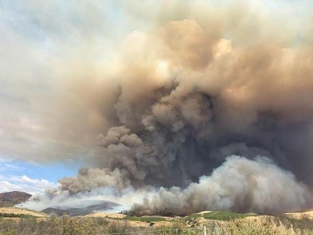
Fires on Kangaroo Island reached their greatest intensity in early January 2020. The devastation was reported by news networks and media outlets worldwide, and with two-thirds of the island burnt, the impact will be felt for many years to come. A Fire Flight fire mapping system was deployed for a few days during the height of the fires to support ground-based relief efforts.
Further details and firemapping results can be found here:
See Fire Results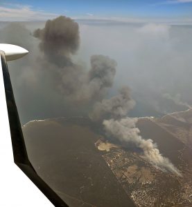
Karte fire, South Australia, January 2018
The Karte fire, which was started by lightning strikes, burnt through native vegetation near the Karte Conservation Park and within the Peebinga Conservation Park on the 20th January 2018. The Fire Flight system was mobilised when it became clear that this fire continued to burn out of control, and fire crews from far and wide were being sent to assist with fire fighting operations.
Further details and fire mapping results can be found here:
See Fire Results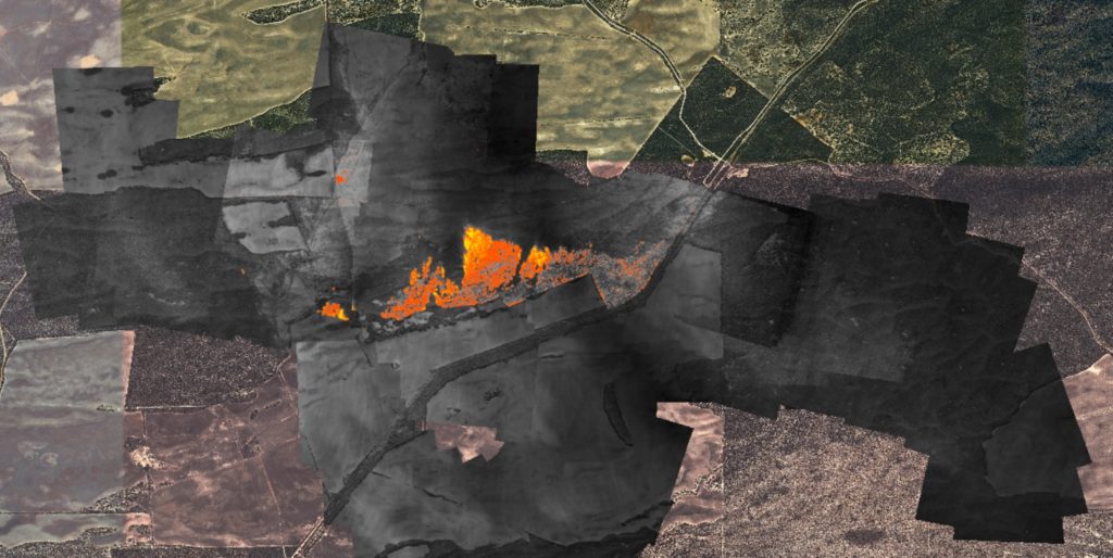
Sherwood fire, South Australia, January 2018
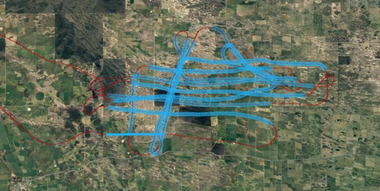
The Sherwood fire took place on the 6th January 2018 in the south east of South Australia. The fire burnt nearly 12,000 hectares (30,000 acres) on a day when weather conditions were classed as “catastrophic”. Due to the high fire danger risk, the Fire Flight system was put on standby early in the day. At 1500 (3pm) local time, the system was flown to the site of the Sherwood fire, and mapping operations began at 1557 local time. Mapping continued for approximate 1.5 hours, during which time nearly 2000 thermal image frames were acquired by the system.
This was the first full test of the Fire Flight mapping system on a large scale, out-of-control fire. On this particular day, the system was not configured for real time data delivery, and therefore could not be used to assist with fighting the fire. However, the system is now fully operational and ready to provide real time data on future fires.
The Fire Flight mapping results can be found here:
See Fire ResultsFull details of the Sherwood fire are given in this Country Fire Service (CFS) media release.
Metz fire, California, May 2016
On the 25th May 2016 the Fire Flight system was used to identify hotspots at the Metz fire, which had been contained the day before. The system detected at least four hotspots: small areas (a few square metres) where intense burning was still present. The image data clearly showed that these hotspots were in the centre of the fire ground, and therefore posed no risk of re-ignition.
See Fire HotspotsThe greyscale image is a thermal map of the burnt area at the Metz fire. The different shades of grey represent different temperatures (dark is cool, and light is hot). Circled on the thermal map are four hotspots: bright white areas which show where fires are still burning. As part of the processing, the thermal image map is fully aligned with map coordinates, so the GPS locations (latitude and longitude) of each hotspot can be easily determined.